ON SAFARI


- Namibia
Waterberg Plateau & central environs
The Waterberg Plateau and central environs
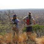
The Waterberg Plateau National Park lies to the south-east of Otjiwarongo and is an interesting massif which rises some 700 ft off the surrounding plains. It is home to some wildlife, including eland and introduced white rhino, but the park is perhaps more important for its birdlife (over 200 species) and flora. Most people use the area to break the long journey between Windhoek and Etosha/Damaraland/the north. Vehicle movement is restricted on the plateau itself and some walking trails are available.
The region is also home to a number of private reserves. To the south-west of Otjiwarongo in the Omboroko Mountains is found the well known Okonjima, home of the Africat Foundation. To the north of the plateau is the much less known Mundulea Nature Reserve, which is ideal for experienced nature lovers who wish to walk in the wilderness with an experienced guide. To the south-west, close to the town of Omaruru and bordering south-west Damaraland, the Erongo Mountains offer a wonderful scenic, walking and birding experience.
- Namibia
Swakopmund & Walvis Bay
Swakopmund and Walvis Bay
The two major coastal towns of Walvis Bay and Swakopmund are just 30 kms apart but serve as a good stopping point between a visit to the Namib Desert and Damaraland to the north. Walvis Bay serves as the main port, whilst Swakopmund developed as the ‘holiday’ destination and is far less ‘industrial’.
Most visitors stay in Swakopmund from which there are numerous excursions including those to Sandwich Harbour, and the interior ‘moon landscape’ and Welwitschia plains. From Walvis harbour, a range of wildlife cruises are also available, particularly to the Pelican Point seal colony (kayaking also possible). Between the two towns, a sand dune belt is used for quad-biking and dune boarding, whilst sky-diving is also possible for anyone seeking an adrenalin adventure!
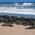
Further up the coast, towards the Skeleton Coast National Park lies the Cape Cross seal colony, home to the largest Cape fur seal colony with some 100 000 ‘residents’.
- Namibia
The Skeleton Coast
The Skeleton Coast
Whilst you could describe the entire length of Namibia’s Atlantic coastline as ‘Skeleton Coast’, the official Skeleton Coast National Park is made up of the narrow coastal belt which stretches north from the Ugab River to the Angola border. The southern section of the park (up to Terrace Bay) can be visited by the general public, although generally a 4×4 would be required (there is little road infrastructure). North of that, the park is closed to all but one company who operate the exclusive Skeleton Coast Safari Camp. Flying safaris along the coast are possible, but north of Terrace Bay landing options are rather limited!
The flat and open beaches of the coastline, which are often shrouded in mist, are home to numerous Cape fur seal colonies, which in turn provide food for black-backed jackals and the rare brown hyaena. Close to the coast, the landscape is a mix of gravel plains and sand dunes, whilst further inland rocky ridges rise out of the desolate plains. At Terrace Bay, it is possible to drive into the sand dunes and experience the ‘roaring dunes’ where sand particles are so uniformly weathered they resonate deeply like a ‘tuba’ when disturbed.
- Namibia
The Namib Desert, Namib Naukluft National Park & Namib Rand Nature Reserve
The Namib Desert, Namib Naukluft National Park and Namib Rand Nature Reserve
The Namib Desert is a region which should be included on any visit to Namibia, and is, quintessentially, what the country is about. The main Namib Naukluft National Park extends from the Luderitz area in the south to the Walvis Bay/Swakopmund area in the north, and inland to cover much of the vast Namib dune belt. To the east are a number of private conservancies from which you can explore this wilderness.
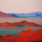
Within the National Park itself lie the renowned Sossusvlei dunes, which rise some 300m from valley floor. Sossusvlei is a huge dried up clay pan formed at the end of the Tsauchab River where the huge dunes stopped its progress toward the sea. Nearby are two other pans, Hidden Vlei and Dead Vlei. If you’re feeling fit, you can climb the dunes for a spectacular view of the surrounding area.
The Sesriem Canyon is one of the most amazing features of this desert. Here, the Tsauchab River has carved a gorge (up to 100 ft deep) into the gravels deposited around 16 million years ago. The canyon dates back to about 3 million years ago, when continental uplift caused the incision of most of the westward flowing rivers in Namibia. The canyon is about a kilometre long and becomes shallower as it makes its way towards Sossusvlei.
Bordering the park, the two most significant conservancies are the Kulala Conservancy and the Namib Rand Nature Reserve. The Namib Rand is huge, covering some 1800 sq.kms., and is stunningly beautiful with a mix of sand dunes and gravel plains, flanked on all sides by rugged mountains. There is a significant amount of wildlife, including oryx, springbok, mountain zebra, giraffe, bat-eared fox, ostrich and the occasional leopard or cheetah. Although it is possible to reach the Sossusvlei dunes on a day trip from the northern section of the Namib Rand, a visit to this conservancy can also combine well with a stay closer to Sossusvlei.
The Kulala Conservancy is closer to Sesriem and although much smaller than the Namib Rand, has direct access into the National Park so is ideal for those with limited time in the region.
- Namibia
Kaokoland
Kaokoland
Kaokoland stretches north from Sesfontein and the Hoanib River Valley to the Kunene River, the border with Angola, and can only be accessed by four-wheel drive. Few people travel far into this land, and those that do, usually do so with an experienced guide, which is highly recommended.
For self-contained 4×4 travel, either self-driving or on a guided safari, the most accessible region is the stunning Hoarasib River Valley, which can be explored for several days from a base at Purros, the closest thing to a town or village in the region. The region is also a stronghold for desert lions and desert elephant, who often come into conflict with the local Himba and Herero villagers, and in the long term tourism into the area should help protect the fragile populations of both. There is one luxury lodge near Purros, and an airstrip for fly-in safaris, but otherwise camping is the usual accommodation choice.
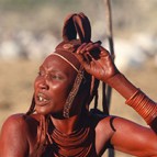
From the Hoarasib stretching northwards is a vast wilderness which is home to the nomadic Himba people, pastoralists who are well known for being ‘not very well known’! In this area you can explore several spectacular valleys and mountain ranges, including the stunning Hartmann Valley which leads to the Kunene River, the Hartmann Mountains, Marienfluss, and the spectacular Van Zyl’s Pass.
The Hartmann Valley is one of the most stunning, remote and awe-inspiring places in Africa. Technically it is no more beautiful than other parts of Namibia, but the real magic is in its remoteness. It is an area of wide open plains flanked by mountains, and sometimes populated with huge herds of springbok and oryx which move through the area. Towards the northern end of the valley, you come across more and more red ‘sand’ which reminds you of the Namib Desert, before reaching the spectacular Kunene River valley, a verdant strip which snakes through the rocky mountains en route to the Atlantic. One luxury lodge and a couple of more adventurous camps exist on the banks of the Kunene, accessed either overland or by air into the Hartmann Valley airstrip.
- Namibia
Fish River Canyon and the far South
Fish River Canyon and the far South
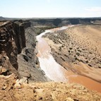
The Fish River Canyon lies in the far south of the country and is the second largest canyon in the world. Certainly off the beaten track (two days drive from Windhoek), visiting here should not be a big priority for those with limited time but the canyon itself is spectacular. Set in a harsh, stony plain, scantily covered with drought-resistant succulents and the distinctive quiver tree or ‘kokerbom’, the canyon represents a spectacular natural phenomenon which took hundreds of millions of years to evolve. The full length of the canyon is 160 kms with a depth of up to 550 metres. Hiking is available in the winter months (May to September). It is possible to walk through the gorge on a five day trail although a permit is required from the Namibia Wildlife Resorts authority. Day walks are more readily available from some of the lodges in the region. Walking in the canyon is hard work and only suitable for confident walkers.
Much of the south-east of the country borders the Kalahari Desert and includes areas such as Bushmanland. There are some limited game-viewing and San culture opportunities, particularly around the town of Mariental.
Luderitz on the coast has changed little since the early 1900’s when the nearby ghost town of Kolmanskop was a bustling diamond centre. The town is still largely surrounded by the Sperrgebiet (the forbidden territory) where a lot of alluvial diamond mining takes place but in essence, it’s no more than a small laid-back trading town. Today, other than visiting Kolmanskop where the Namib sands sift through the dilapidated buildings to create interesting photographic opportunities, there is little reason for going ‘out of your way’ to visit the region.
- Namibia
Etosha Pan
Etosha Pan
Etosha National Park lies to the east of northern Damaraland/ southern Kaokoland and is Namibia’s main wildlife area. The 22,270 sq. kms. park was proclaimed a game reserve as early as 1907 (after years of being a hunter’s paradise), but it was not until 1952 that the park was developed. In 1958, it gained its National Park status. The famous pan, which covers an area of some 4,900 sq. kms. was discovered in 1815 and, according to geologists, is the remains of a huge inland lake, fed millions of years ago by the Kunene River, which changed course causing the lake to shrink to its present size. During the rains, the pan does hold sufficient water to enable millions of waterfowl to descend onto it, including greater flamingo which breed here. The extensive habitat is home for some 340 species of birds.
The vegetation varies from the desolate sands of the pan to the surrounding grass plains (of salt-loving grasses and shrubs) to the deciduous bush (consisting mainly of mopane) and mixed woodland (wild figs, wild dates, maroela and tamboti) which covers much of the ground away from the pan. With the exception of buffalo, most of Africa’s large mammals are found, including healthy lion, elephant and rhino (black and white) populations. The area is also particularly good for greater kudu and black-faced impala.
The best way to game-view through the park is to spend time visiting the various waterholes which are found south of the pan itself. These attract a wide range of wildlife species, and those with patience will reap the best rewards.
There are currently three accommodation restcamps and one luxury lodge within the park, all run by Namibia Wildlife Resorts (the National Parks body) and whilst Etosha is definitely worth visiting, it is extremely busy and you’ll not have a particularly ‘exclusive’ safari experience.
Adjoining the southern boundary of the park near the Andersson Gate entrance is the Ongava Game Reserve, a privately owned property which offers a more traditional game-viewing experience. On the eastern boundary of the park, near the Von Lindequist Gate are numerous luxury lodges set on their own private concessions, but outside of the park itself they offer a limited safari experience.
- Namibia
Damaraland
Damaraland
The Damaraland region is huge, stretching inland from the southern section of the Skeleton Coast National Park, from the Omaruru River in the south to the Hoanib River in the north. Although mostly accessible, Damaraland is rugged and wild, especially in the north and west.
The southern section includes Messum Crater (inland from Cape Cross), the small town of Uis and the Brandberg Massif with its renowned rock art. The Brandberg is the highest mountain in Namibia at 2573m, and offers adventurous walking and some excellent birding.
The central section is arguably the best known area where Twyfelfontein (home to the famous rock engravings), the Burnt Mountain, the Organ Pipes and the Petrified forest lie close to the town of Khorixas. To the west of Twyfelfontein, around the Ugab and Huab Rivers, the landscape is incredibly harsh, a truly remote and rocky wilderness. The Huab Valley in particular forms part of a community conservancy, where just a couple of exclusive camps operate. Rhino are gradually being re-introduced to this area, which is already known for its ‘desert’ elephant populations.
The northern section includes two huge community conservancies, separated by the main road running north from the village of Palmwag to the outpost town of Sesfontein. Bordering the Skeleton Coast National Park to the west and adjoining the spectacular Hoanib River to the north, the Palmwag Concession is a vast and rugged wilderness which has the largest populations of desert black rhino in Namibia, in addition to a variety of general game including elephant, lion, cheetah, mountain zebra, giraffe, oryx, springbok and leopard. The concession is home to the Save the Rhino project, and there are very limited opportunities to track the desert rhino with the Save the Rhino scouts. To the east of the main road lie the Etendeka and Grootberg Mountains. This region is equally impressive with similar game species found, though the rhino and elephant populations are a little more sparse. A couple of good lodges offer exploration of the region by vehicle or on foot. The whole western and northern section of Damaraland is extremely remote wilderness country, with stunning rugged scenery which blends into the Kunene Province to the north known as Kaokoland.
- Namibia
The Caprivi Strip
The Caprivi Strip
The Caprivi Strip is that finger of north-east Namibia which stretches eastwards and is sandwiched between Angola/Zambia in the north, and Botswana in the south. The habitat is completely different to the rest of Namibia and is largely influenced by the four major rivers which form the boundaries or bisect it – the Zambezi, Chobe, Kwando and Okavango. Mahango, Babatwa, Mudumu and Mamili national parks are far more like the wildlife areas of Botswana, though in terms of wildlife, they are the ‘poorer relations’. The exception is possibly a small area of land at the eastern end of the Babatwa National Park, where an upmarket safari lodge can be visited and there are reasonable populations of big game.
Excellent birding and fishing can be found throughout the Caprivi, especially in the far east where Katimo Mulilo offers access to the Zambezi River and Impalila Island to the Chobe River. There are a couple of excellent lodges on Impalila Island which are most easily accessed from Kasane (Botswana) and often used as an alternative to the busy mainstream safari lodges found in Botswana’s Chobe National Park.
- Namibia
Regions
Wildlife regions and attractions in Namibia
Namibia is a vast country stretching from the Kunene River in the north to the Orange River in the south, a distance of some 1500 kms. It is dominated by central highlands which split the Atlantic coastal belt from the arid Kalahari basin to the east. Unless you have plenty of time on your hands, it is a mistake to try and do too much as the country is simply too big. However, if you’re looking for incredible desert scenery and ‘extreme’ wilderness, Namibia is certainly the country to go to.